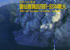
Photo Sets of
Unzen Volcano 1991-93 Eruption
-
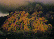
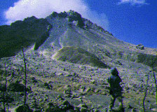
Pyroclastic flow cascading down in the northeast slope of
Mt. Fugen, Unzen Volcano. Skirt of ash-cloud surges laterally
from the flow base. November 8, 1991 (photo by T. Ui)
-
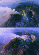
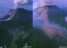
Change of the northeastern aerial view of lava dome after ten
months. March 2 and December 18, 1993. (photo by T. Matsushima)
-
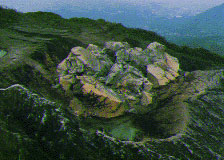
Dacite lava dome filling Jigokuato Crater, three days after dome birth.
May 23, 1991. (photo by S. Nakada)
-
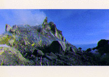
Lava dome and devastated crater from near the ground level, looking
southeast. October 9, 1993. (photo by T. Matsushima)
-
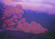
Expanding turbulent front of a pyroclastic flow in the northeast part
of Shimabara City. Early morning of June 24, 1993.
(photo by Nagasaki Photo Service Co., Ltd.)
-
Pyroclastic flow attacking the residential area in Shimabara City.
June 24, 1993, 05:28. (photo by S. Nakada)
-
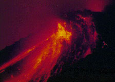
Night view showing incandescent rockfalls from toes of the lava dome.
October 2, 1991. (photo by Nagasaki Photo Service Co., Ltd.)
-
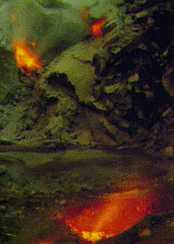
High-temperature volcanic gas emitted from the periphery of the lava
dome on Jigokuato Crater. Evening of October 1, 1992. (photo by H. Shimizu)
-
Growing lava dome and Akamatsu Valley filled with pyroclastic flow
deposits. August 27, 1992. (photo by H. Shimizu)
-
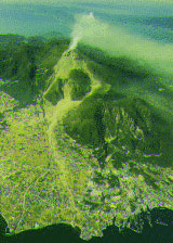
Eastern view of active Mt. Fugen, Unzen Volcano, with an apron of
pyroclastic flow deposits. Large amphitheater for 1792 Mayuyama
collapse is seen at the back of Shimabara City (lower right). January 20, 1992.
(photo by Asia Air Survey Co., Ltd.)
-
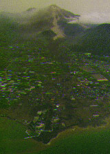
Scenes of the northwest district in Shimabara City before and after
a pyroclastic flow devastation. (photo by Nagasaki Photo Service Co., Ltd.)
-
Debris-flow deposits flooding over the Mizunashi River. May 3, 1993.
(photo by Nagasaki Photo Service Co., Ltd.)
-
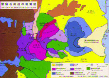
Geologic Map of Unzen Volcano (simplified from Tanaka and Nakada: 1988)